BY MATT PIKE
St Joseph Post
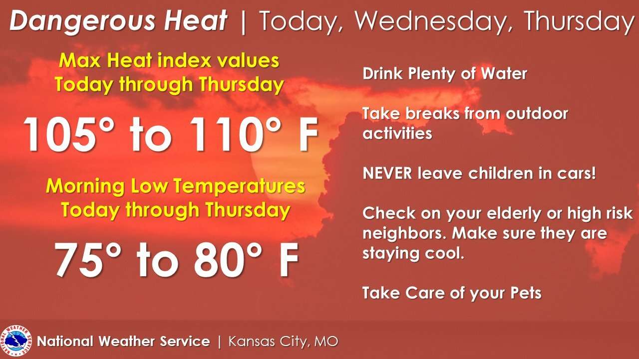
Extreme heat has plagued the area.
National Weather Service Meteorologist Brent Pesel says the extreme heat is prompting the National Weather Service to issue a warning.
"We do have heat advisories and excessive heat warnings out for much of Northwest Missouri through the evening on Thursday," Pesel says. "Looking at temperatures, actual temperatures, reaching up to around the mid to upper 90's, with heat indicies reaching 105 to 110."
Pesel says there should be some reprieve later this week, when temperatures are expected to cool down with showers and thunderstorms Thursday night into Friday. The cool front should continue into the weekend with temps in the low to mid 80's.
Pesel adds people should stay hydrated by drinking plenty of water and should try to stay as cool as possible in the heat, because it is more dangerous than it seems.
"It's actually one of the leading causes of weather fatalities in the United States is heat," Pesel says. "Of course the most dangerous portions of the day are during the daylight hours, more so in the afternoon when heating is at its peak."
The extreme heat looks like it might move out of area later this week.
"It's looking like we are going to have a cold front come through overnight Thursday into Friday, bringing some showers and thunderstorms through the area," Pesel says. "And then it looks like going into the weekend temperatures reset back down to the low to mid 80's."
But for now excessive heat advisories remain in the area with temperatures in the upper 90's and heat indices well over 100.